River Balder
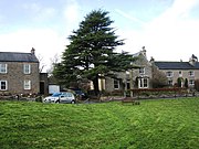
River in County Durham, EnglandThe Balder is an English river that rises on the eastern slope of Stainmore Common in the Pennine Chain and flows eastwards for about 23.4 kilometres (14.5 mi), before joining the River Tees at Cotherstone.
Read article
Top Questions
AI generatedMore questions
Nearby Places
![Thumbnail](https://upload.wikimedia.org/wikipedia/commons/thumb/1/1b/The_Village_Green_at_Cotherstone_-_geograph.org.uk_-_1593177.jpg/180px-The_Village_Green_at_Cotherstone_-_geograph.org.uk_-_1593177.jpg)
Cotherstone
Village in County Durham, England
![Thumbnail](https://upload.wikimedia.org/wikipedia/commons/thumb/4/4d/Hunderthwaite_-_geograph.org.uk_-_277797.jpg/180px-Hunderthwaite_-_geograph.org.uk_-_277797.jpg)
Hunderthwaite
Village and civil parish in England
![Thumbnail](https://upload.wikimedia.org/wikipedia/commons/thumb/8/8b/Romaldkirk.jpg/180px-Romaldkirk.jpg)
Romaldkirk
Village in County Durham, England
![Thumbnail](https://upload.wikimedia.org/wikipedia/commons/thumb/6/69/The_Station%2C_Low_Lathbury%2C_Cotherstone_%28geograph_6325145%29.jpg/180px-The_Station%2C_Low_Lathbury%2C_Cotherstone_%28geograph_6325145%29.jpg)
Cotherstone railway station
Former railway station in County Durham, England
![Thumbnail](https://upload.wikimedia.org/wikipedia/commons/thumb/f/fc/Semaphore_Signal%2C_Romaldkirk_%28geograph_5865098%29.jpg/180px-Semaphore_Signal%2C_Romaldkirk_%28geograph_5865098%29.jpg)
Romaldkirk railway station
Former railway station in County Durham, England
![Thumbnail](https://upload.wikimedia.org/wikipedia/commons/thumb/c/cf/The_remains_of_Cotherstone_Castle.jpg/180px-The_remains_of_Cotherstone_Castle.jpg)
Cotherstone Castle
Castle in Durham, England
Baldersdale Woodlands
Woodland in County Durham, England
Shipley and Great Woods